
Water Resources in TEXAS
Ground Water Supplies and Use:
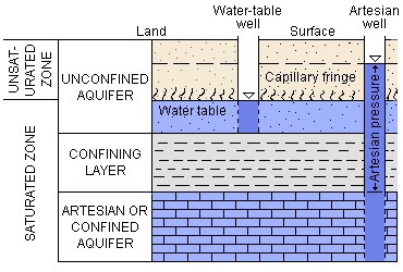
What is an Aquifer?
An aquifer is a geologic formation, group of formations, or part of a formation that contains sufficient saturated permeable material to yield significant quantities of water to springs and wells. Use of the term is often restricted to those water-bearing formations capable of yielding water in sufficient quantity to constitute a usable supply for people's uses.
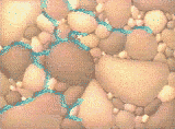
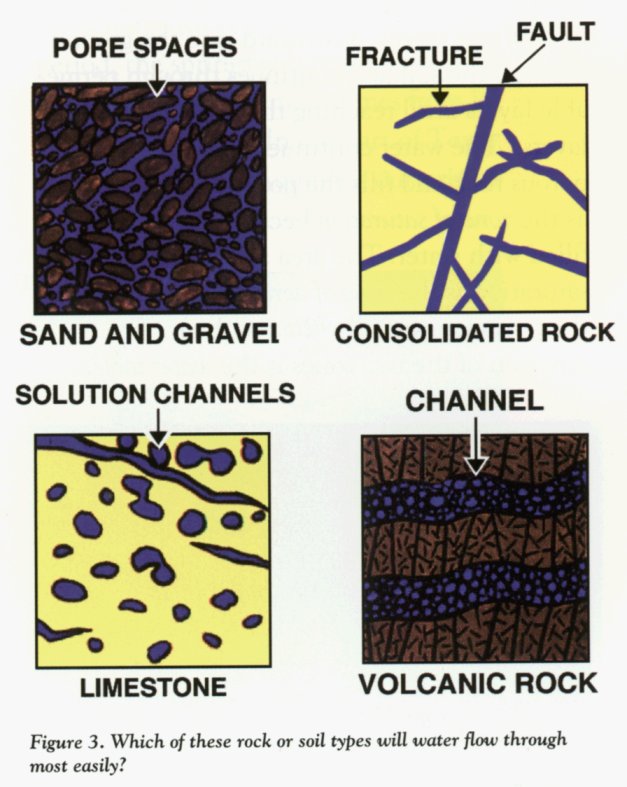
Aquifers are underground layers of porous rock or sand that allow the movement of water between layers of non-porous rock (sandstone, gravel, or fractured limestone or granite). Water is held between rock particles. Water infiltrates into the soil through pores, cracks, and other spaces until it reaches the zone of saturation where all of the spaces are filled with water (rather than air). The zone of saturation occurs because water infiltrating the soil reaches an impermeable layer of rocks so that it is not able to penetrate any further into the earth. Water held in aquifers is know as groundwater.
Aquifer Recharge: How does water gets into aquifers?
Water may become added to aquifers naturally as water moves down through the soil. The area over which water infiltrates into an aquifer is known as the “recharge zone”. The recharge zone above unconfined aquifers is generally the area above the aquifer because water is able to move directly from the surface into the aquifer. However, for a confined aquifer, the recharge zone may be limited to the range where the impermeable layer reaches the surface.
Because water has to infiltrate through layers of soil and rocks in order to reach an aquifer, rates of recharge can be very slow and low. Some aquifers were formed a long time ago and they no longer are actively recharged (some people refer to these types of aquifers as containing “fossil water”).
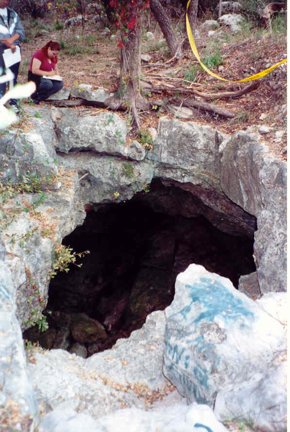
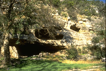
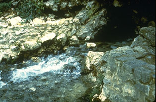
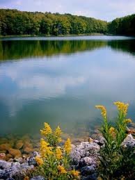
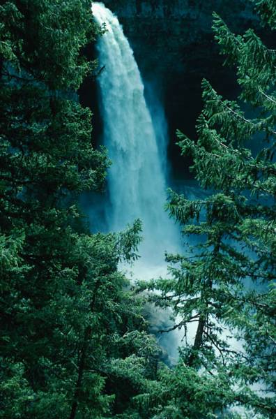
Groundwater can move through aquifers until it reaches an opening to the surface. In a seep, the water reaches the surface over a large area. In a spring, water flows from the earth at a small point. Because of the pressure of the water above it, water in confined aquifers is generally under high pressure and can result in the production of an artesian spring. Springs and seeps will only continue to flow as long as the water table is higher than they are. Because of movement of water, the location of the recharge zone may be far from the location of seeps and springs.
Aquifers underlie about 76% of the area of Texas. This ground water has long been the principal source of municipal supplies but cities now increasingly depend upon surface reservoirs due to the depletion of water in aquifer storage.
In Texas, groundwater is used for
- irrigation (79.4%),
- municipal water supplies (13.5%),
- manufacturing (3.6%),
- mining (1.4%),
- livestock (1.2%)
- power production (0.9%).
The major aquifers in Texas include the
- Ogalalla aquifer, the
- Gulf Coast aquifer, the
- Edwards aquifer,
- Carrizo-Wilcox aquifer,
- Edwards-Trinity (Plateau) aquifer, the
- Seymour aquifer, the
- Hueco-Mesilla Bolson, and the
- Cenozoic Pecos aquifer.
The Ogalalla Aquifer, the largest aquifer in North America, covers 174,000 square miles in 8 states (Texas, Oklahoma, Kansas, Nebraska, New Mexico, Colorado, South Dakota, and Wyoming) and incorporates some of the most important agricultural land in the nation. More than 14 million hectares of land are irrigated by the Ogallala.
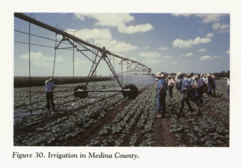
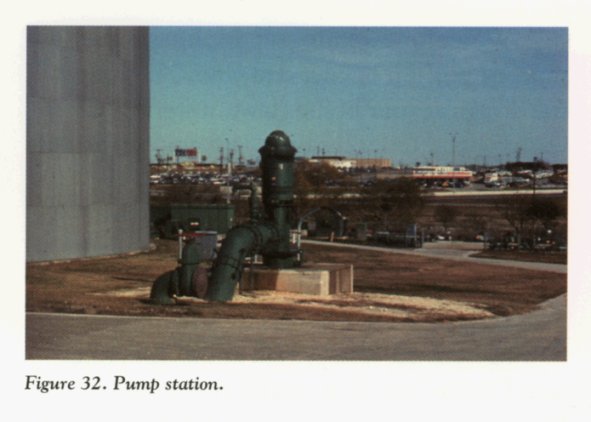
More than half of Texas' total agricultural crop value is produced utilizing ground water for irrigation mainly from the High Plains Ogallala Aquifer which underlies the panhandle of Texas. The major aquifers are important sources of water for major Texas cities (e.g. Gulf Coast aquifer-Houston, Edwards Aquifer-San Antonio, and Hueco-Mesilla Bolson-El Paso). Many of the the largest municipalities of Texas rely on aquifers to meet their water needs (e.g., San Antonio- 98%), although the reliance on water from aquifers has decreased. For example, in 1990 Harris County (Houston) 71% of water came from aquifer compared to 26% in 2000 and in El Paso reliance on groundwater has decreased from 79% in 1990 to 25% in 2000.
Water can also be removed from aquifers by the activity of humans drilling wells. Aquifers have historically been extremely important for humans who have used the water for watering livestock, irrigating crops, powering mills, and as a source of municipal water. If rates of removal of water for human use exceed the very slow, natural rate of recharge, then the total amount of water in the aquifer is reduced which results in a lowering of the water table (aquifer depletion). Lower water tables require deeper wells which greatly increases the cost of pumping water from aquifers and further depletes water from the already slow, natural rate of recharge.
Declining water levels, mining and exhaustion of ground water coupled with increasing energy costs are major problems facing the state's water managers today.
Sample Types of Aquifers in Texas:
The Ogallala Aquifer: This formation furnishes practically the only usable water on the High Plains . It is composed of unconsolidated fine to coarse-grained gray and red sand, clay, silt and gravel. Effective recharge from participation is small, averaging less than one quarter inch yearly, whereas ground water pumping is heavy, averaging about 5.5 million acre-feet yearly (historical average).
It estimated that this vast aquifer contained 2 billion acre feet of water in porous rock layers, ranging in thickness from a few meters to 400 meters in the center of the sand formations in Nebraska. This is about 16 times as much water as all lakes, streams, rivers, marshes, and other surface fresh water bodies on Earth. Most of the water in the aquifer is thought to have been left by the glaciers that melted 15,000 years ago. In 1930 the average depth of the water was 58 ft, in 1987, it was less than 8 ft. and falling Some places over the Ogallala Aquifer are essentially out of water.
This depletion at the current rate, threatens this as a water source for irrigation and other needs. The High Plains Ogallala aquifer supplies Texas' largest irrigated farming region which produces most of the Texas cotton and grain sorghum as well as other crops.
Alluvium and Bolson Deposits: These water bearing deposits are scattered throughout many areas of Texas. They include the Hueco and Mesilla Bolsons, the Cenozoic Alluvium of West Texas, the alluviums of North Central Texas, the Leona Alluvium of Southwest Texas. These deposits consist of sand, gravel, silt and clay. The quality of water can range from fresh to saline.
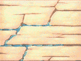
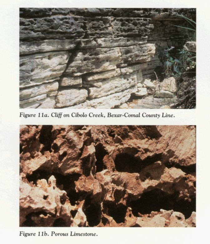
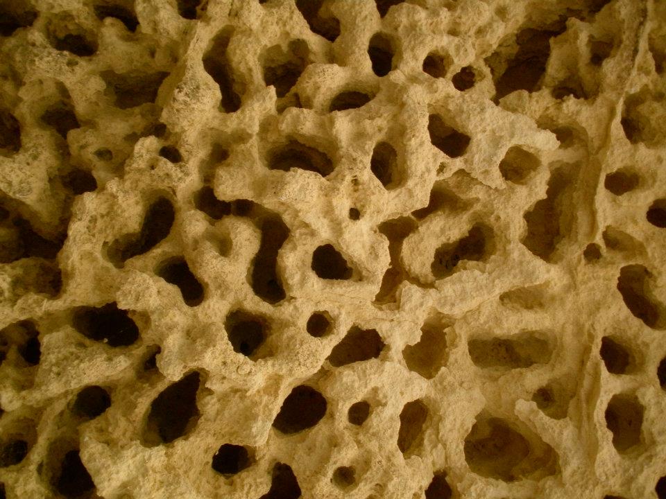
Edwards Aquifer (Balcones Fault Zone): In this formation ground water occurs in fractures , honeycomb zones and solution channels that underlay an area around the Balcones Fault Zone from Kenny County on the west to Bexar County to Bell County on the north. Geologically it is made up of Edwards and associated lime stones of the Cretaceous age and consists of massive to thing bedded, modular, cherty, gypsiferous and argilaceous white to gray limestone and dolomite of the Comanche Peak, Edwards and Georgetown formations which have been down thrown from the Edwards Plateau due to faulting.
The Edwards Aquifer is recharged rapidly by water discharging from the Edwards Plateau, which then flows in streams that traverse the many faults along the Balcones. The ground water moves through the aquifer generally in an easterly , northeasterly direction to points of discharge notable of which are the Leona, San Antonio, San Pedro, Comal, San Marcus, Barton and Salado Springs plus numerous smaller springs. In Bexar County, wells pumping from this aquifer are the worlds largest and the water is of good quality. Hydrologically, the Edwards Aquifer is unique and it is one of the states most valuable natural resources.
Resource:
Mark McGinley (Lead Author);USGS (Content Source);Harold Ornes (Topic Editor) "Aquifer". In: Encyclopedia of Earth. Eds. Cutler J. Cleveland (Washington, D.C.: Environmental Information Coalition, National Council for Science and the Environment). [First published in the Encyclopedia of Earth April 5, 2007; Last revised Date November 11, 2011; Retrieved March 9, 2012 <http://www.eoearth.org/article/Aquifer>
FOR FURTHER INFORMATION please visit:

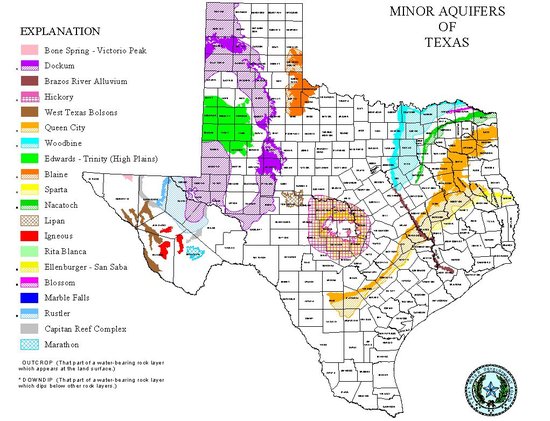
(For a map of our Texas Aquifers
please click on each map above)
Protect Each Drop brought to you by MASCAT Consultants
Watershed Protection: Water Protect Each Drop brought to you by Alamo RCD Area Inc.